The world is getting used to Deepfakes, fake videos created by artificial intelligence, and the latest reports show that this technology can also be used for satellite imagery and this situation poses a great risk according to geographers. Now AI-generated maps could be used as disinformation tools.
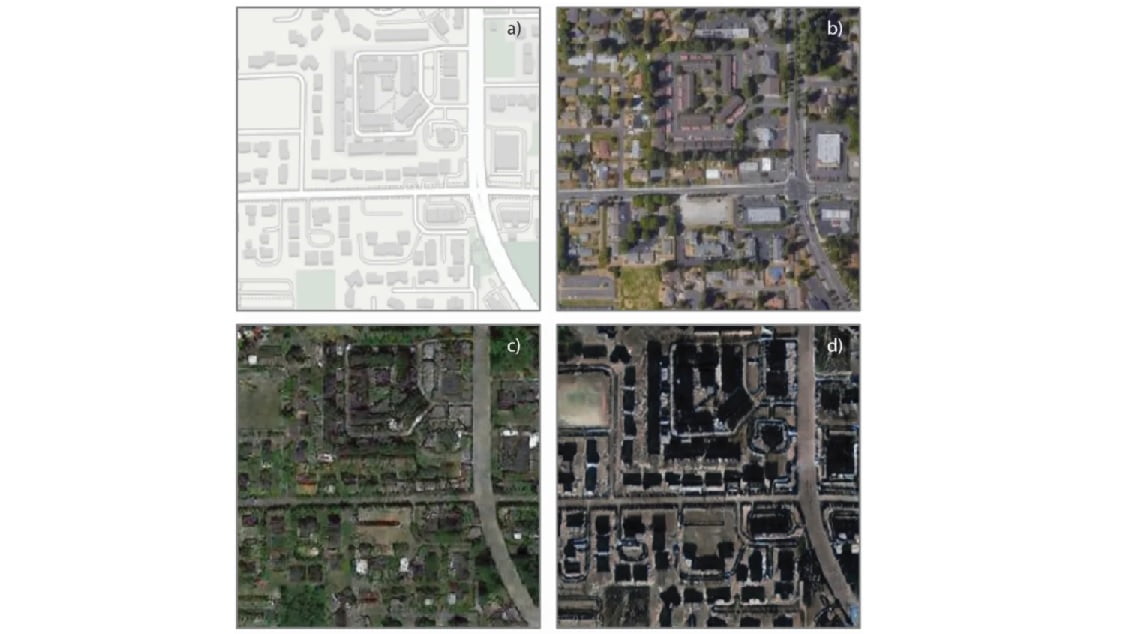
A group of researchers at the University of Washington created a way to generate detailed satellite photographs to detect manipulated images. This experiment provides insight into how these fake cities are made.
This is how Deepfake satellite imagery is created
Let’s take a city, for example, New York. We superimpose buildings from Washington or Chicago on it, generating a totally different city. The execution is not perfect, but it is good enough to make people think that these are errors generated by the low quality of the image.
After creating the software to generate the Deepfake satellite images, they prepared another one capable of detecting the fakes based on texture, contrast, and color.
Bo Zhao, assistant professor of geography at the University of Washington, is leading the research.

“We want to demystify the function of absolute reliability of satellite images and to raise public awareness of the potential influence of deep fake geography,” Zhao said.
“While many GIS [geographic information system] practitioners have been celebrating the technical merits of deep learning and other types of AI for geographical problem solving, few have publicly recognized or criticized the potential threats of deep fake to the field of geography or beyond,” Zhao adds.
It is easier to produce fake satellite images than fake videos of human beings. Lower resolutions, Zhao explains, can be very convincing.


