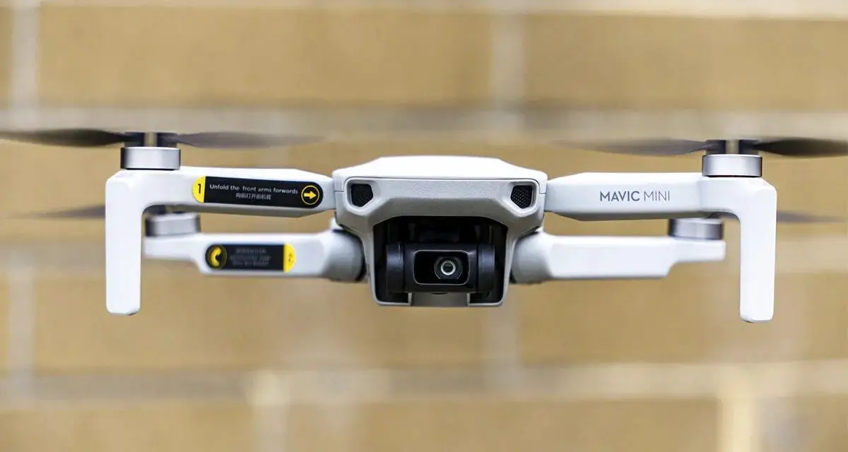
We listed the best Android drone apps, so that you can learn to fly and train with them. We show you a compilation of the best apps to plan flights with your drones safely.
If you have just acquired the drone you were longing for or if you are thinking of getting one, you will need some apps for Android drones that will help you to improve your flying experience.
No matter if you are flying drones for entertainment or professionally, you will always need to have some add-ons that will allow you to get the most out of your drone’s time in the air.
For this, we will tell you about some additional applications that we consider essential, both when planning your flight and to safely enjoy this incredible experience.
Best Android apps for flying drones
If you need an app to make sure the zones allowed to fly your drone, get the weather report or simply keep track of your flights, here are the best Android drone apps you can’t miss on your mobile device.
Pix4d Capture
Pix4d Capture is one of the most used applications by drone users when planning their flights. It consists of a tool that will help you map the area you want to fly over with your aircraft.
It is very simple and practical to use, where among other sections, you can manage flights in the form of a grid, double grid (overlapping two perpendicular grids), circular flights, and even join several of the above within a single flight automatically.
It also allows you to easily configure the speed, camera tilt angle, and the percentage of overlap between images. It is completely free in the Play Store.
Also, you can download the app from the following link.
Dronecast
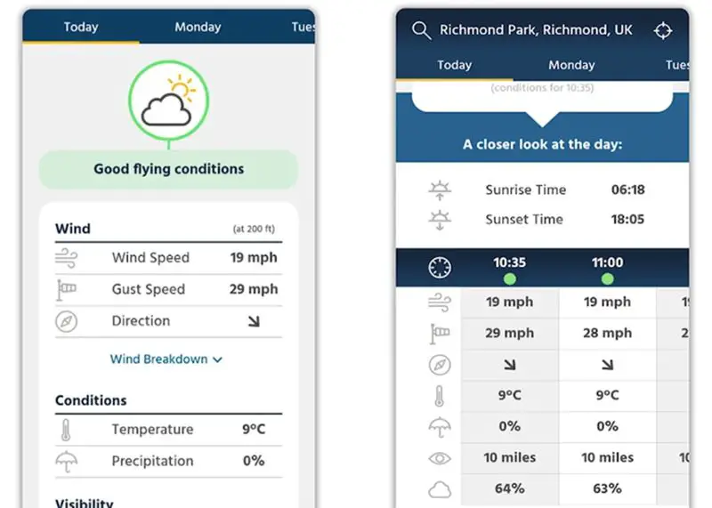
Dronecast is one of the most complete apps for flying drones that you can find on Android. From weather information to flight paths, it’s a great add-on.
Just enter the platform and get real-time weather forecasts, exclusion zones thanks to its integration with Airmap within the US, UK, Europe, Asia, and more.
It has great customization according to your drone model and flight capacity, get a forecast of the next 7 days to plan future flight missions, totally free and without advertising.
Also, you can download the app from the following link.
UAV Forecast
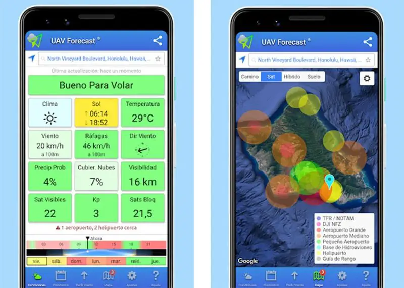
One of the most important aspects when flying a drone is the weather conditions and thanks to UAV Forecast, you will have detailed information about the wind and weather to know if the environmental conditions are ideal for flying.
One of the most outstanding features is that you can set the parameters of your drone and the app will give you the necessary information to know the speed and direction of the wind, wind chill and temperature, cloud cover, visibility, and other sections allow the movement of your ship.
If you need it, you can also get detailed maps with visible no-fly zones, among other options. It is free and can be very useful when planning your flight missions.
Also, you can download the app from the following link.
Airmap
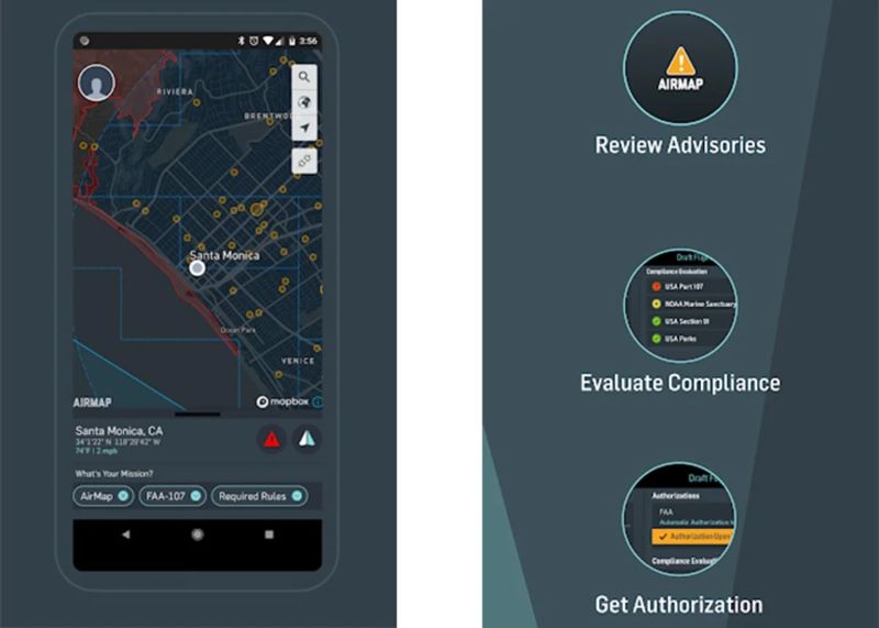
This is one of the best apps for Android drones and it is also a leading platform for aeronautical data and services for drones and UAVs globally. It is a very complete tool to plan your flights with total security and confidence.
Get real-time information on flight rules and conditions, as well as airspace regulations for more than 20 countries around the world. In addition, it has different map styles to suit your needs.
With Airmap you can create and manage your pilot profile and UAV aircraft, plan your flight path according to a certain duration, altitude, and airspace requirements.
We can’t forget the feature to receive real-time traffic alerts when other drones are in the area and show shared flights publicly in the world. It’s free on the Play Store, so check it out.
Also, you can download the app from the following link.
Enaire Drones
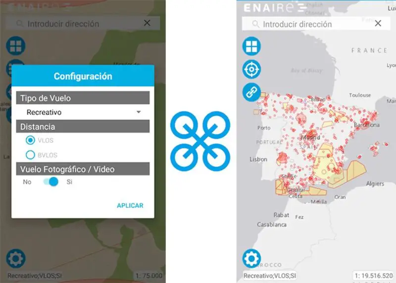
Enaire Drones is an official application of the Spanish government that is very useful for any user, in which you can know the possibility of flying or not your drone in the area where you are and in general within Spain.
In short, it is an app that tells you what you can and what you should not do when flying a drone in Spain. Get access through maps to restricted areas categorized by color, information on flight restrictions by location or in case they are temporary, flight warnings, and much more in real-time.
It is perfect for recreational or professional drone flights. Although it is still in the beta phase, it will progressively include all the features offered by the web, such as route plotting or distance calculation. Download it for free from the Play Store.
As you know, one of the essential requirements to be able to fly a drone is to register it with a competent body according to the corresponding regulations. If you have already done this step, then it’s time to start enjoying the altitude.
Also, you can download the app from the following link.
Aloft
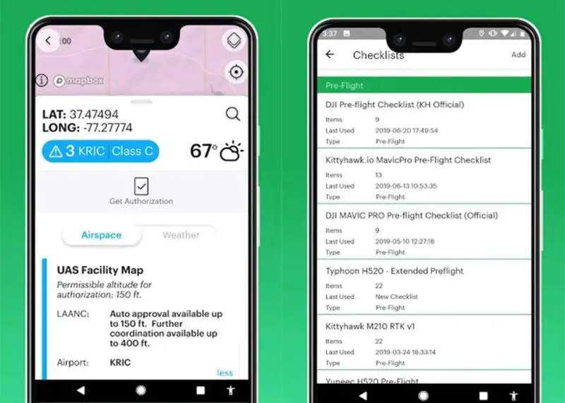
Aloft is one of the best apps for Android drones and also very complete. It offers weather and airspace reports, flight data logging, audio, and video streaming, and much more.
All these tools and functions allow users to fly their drones in a safe and reliable environment. It is also a service approved by the Federal Aviation Administration (FAA) and free for Android phones, the only disadvantage is that it is not in some language, but the developer promises to bring the service to other countries.
Also, you can download the app from the following link.
Anyway, we hope that with these apps for Android drones you can improve your flight experience and take it to the next level, always safely with a drone.

